

Creating a terrain
Hi! Welcome to NDunes. This first tutorial gives some insights on how to use NDunes to assemble Terrains from the ground up, using Soils.
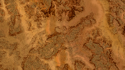
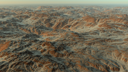
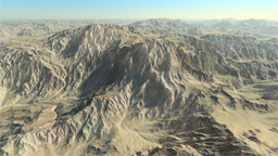
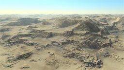
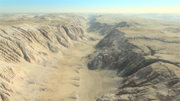
This video focuses on essential tasks to remain easy to watch. To get it right you'll need elevation maps and color maps as a start. The first soil is called a "first level soil" because it sculpts the terrain, unlike "secondary soils" that add details to the terrain. This is illustrated here: First level soil vs. secondary soils.
Note that one step that has been skipped to keep the video short is the calculation of the ambient occlusion layer of soils. While NDunes will work without, the resulting rendering quality will be much better with a properly defined AO. See here how to do it: Soils. It's a one button click task.
Similarly, soils defined in that video don't have these extra channels defined:
- Flow maps (Adding flow maps),
- Masks (Adding masks),
- Densities (Defining vegetation densities),
These channels may be needed at some point in the design process to taylor the terrain and have it look better and containing more details and variations.
Note that if you don't have sample data available to start with NDunes, you can still access our free samples here: Sample data, that may provide some helpful assistance.
 Getting started Getting started | Adding a biome |
