


Using ASC files
ASC files are elevation text files provided by IGN France and downloadable for free. You can use this elevation data to generate elevation textures to use in your soils that match the real world.
Each ASC file is a tile of 1000 x 1000 values of elevation.
ASC files come in 3 possible precisions 1 meter, 5 meters and 25 meters.
Which means that two neighbour values inside the tile will be spaced by either 1m, 5m or 25m where we do not have the value, and an average between neighbouring values will be done. So 1 file of a 5m precision departement will cover a square tile of 5 x 1000m = 5 km by 5 km.
Contrary to what may seem logical, it is not always advisable to use 1m precision files. These files are created based on satellite images, which means at a 1m precision you will be able to detect the buildings, trees etc. These are not details that you want to translate as terrain elevation in NDunes, this is why we advise the use of 5m precision files.
- Download the files from a departement
- Unzip the downloaded folder
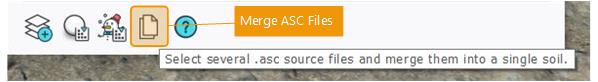
- In your soil document view, clic on the "Merge ASC files" button. The windows explorer will open.
- Select as many ASC files as you want. One file is a tile of elevation data, so you must select the tiles that are next to each other if you want a continuous elevation texture.
Let's try it with a concrete case :
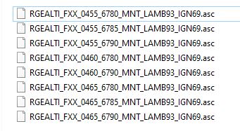
- I downloaded the D072 Sarthe departement in precision 5 meters.
- I clicked on the Merge ASC files button and selected the 8 following files
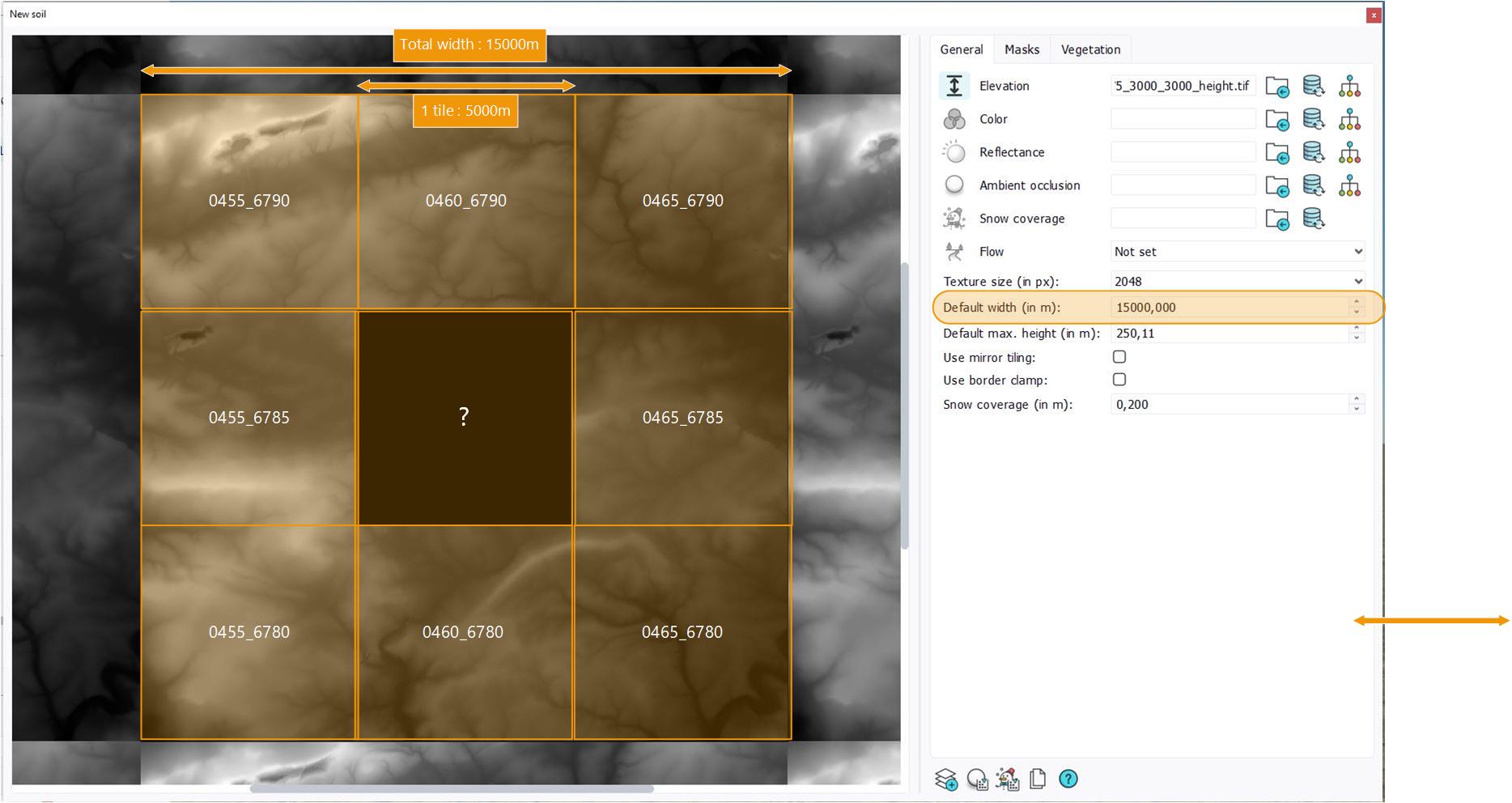
Automatically, an elevation texture named asc_merge_455_6775_3000_3000_height.tif is generated, along with a text file with the same name. These files are located in your working directory next to your soil document, and automatically set as elevation texture, so we get this result in the soil view.
Let's analyse the generated texture :
- The asc tiles are automatically placed next to each other in the correct order.
- The generated texture is always square, so to have a continuous elevation signal, you must select all the necessary tiles to form a square ( 1 tile, or 2x2, or 3x3... etc).
- When there is a tile missing it is replaced by an elevation of 0. In this example, I selected only 8 tiles instead of 9 and forgot the tile RGEALTI_FXX_0460_6785_MNT_LAMB93_IGN69.asc in the middle of the generated texture.
Once your elevation texture is correct, you can use the node graphs to generate your other soil channels (color, flow etc) using the Graph editor. This is the process automatically done in the Blueprints to generate a complete primary soil from the ASC files covering the OpenStreetMap zone.
 Adding flow maps Adding flow maps |
