

Atlases
An atlas defines all high level parameters of a planet:
- Its atmosphere. See Defining a planet's atmosphere. for further details on how to customize an atlas atmosphere.
- Its cartography. See Defining a planet's cartography for details on this process.
The atlas cartography is used to define terrains based on real satellite data.
Creating an atlas
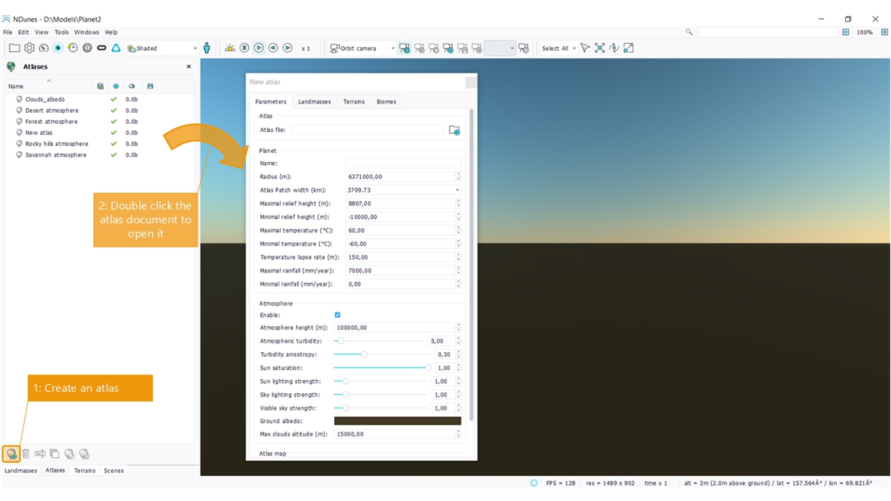
Like all other documents, the atlas creation procedure is quite simple:
- Open the atlas document view and click on the create atlas button.
- Open the atlas document by double clicking on it.
Using an atlas
Drop the atlas into the main view to add it to the current scene and see it in use.
Defining planet parameters
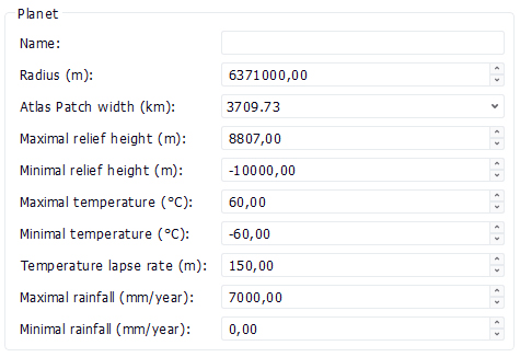
A number of parameters can be modified to create custom planets. By default the setup is ready for the rendering of earth parts, so it does not need to be taylored.
Changing temperature and rainfall parameters may change the scattering of plants from biomes, if these biomes have defined living conditions for the plants they contain.
Defining a planet's atmosphere. |
