

The first level soil
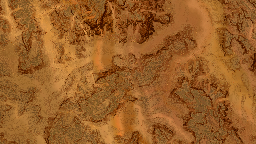
The first level soil is the relief definition soil. This is very important as this soil is the only one that defines the slope of the generated terrain. Here's a typical first level soil below showing terraced hills, defined at 1 meter per texel:
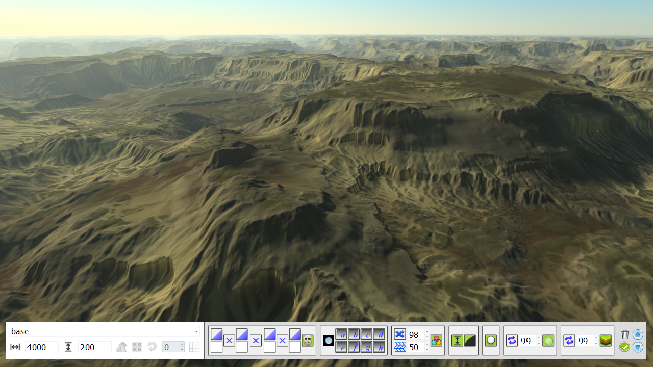
That soil uses a color OVERLAY blending mode as detailed here: Influencing soils, it has several masks that'll be used to define regions where secondary soils will be applied. This soil is the only one that compose the shape of the landscape. It defines the height and slope of the terrain. It's the only one that has a slope output that can be used to define masks:

Height is on the left and slope is on the right.
Understanding height overlay
The usage of height overlay may seem non natural to layer based terrain definition. Nevertheless it's a very powerful tool in the sense that it allows sculpting an initial signal rather than accumulating informations to compose the signal. That way the entire shape of the terrain can be sculpted once in a definition soil (the first soil) and then can be refined by adding secondary soils. This is illustrated below. Let's consider a close-up on our first level soil:
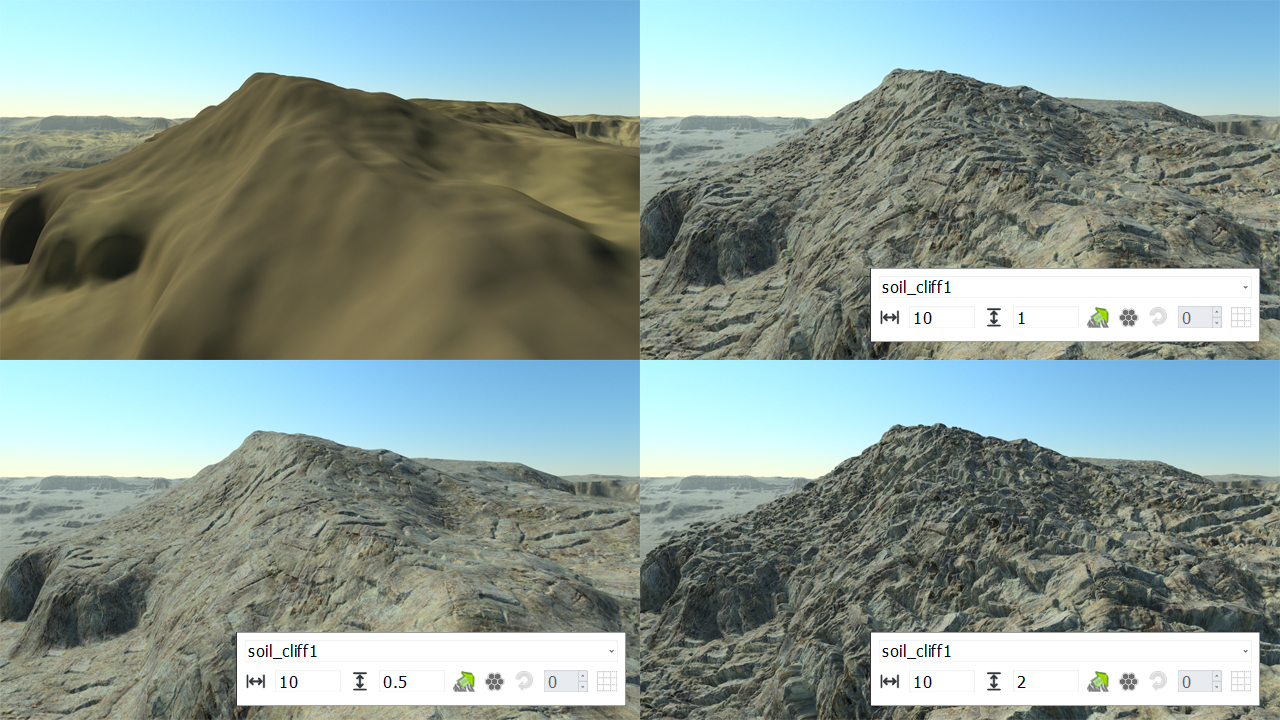
On adding a secondary soil over it, we keep the original shape of the first level soil even if our added secondary soil has a large height amplitude (2 meters in the bottom right corner). The OVERLAY will sculpt the first level soil, using the secondary soil height map to carve the first soil (low height regions of the secondary soil) or to emboss it (high height regions of the secondary soil). If we had been working by simply cumulating the height of soils we would have ended up with something showing blobby rock formations and a lot of roundness everywhere!
Using color distortion
Color distortion is a small feature that can be useful to remove the blurriness of a soil's color. It's mostly useful for first level soils that have large texels when zoomed in; Activating the color distortion will jitter the color between texels using a fractal noise so that the blurriness effect tend to disappear:
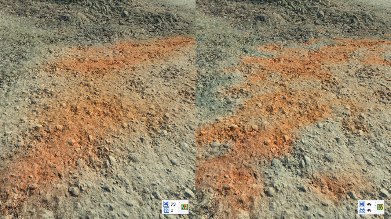
In the picture above, the left size image has the distortion disabled so we can see quite smooth transitions between the colors of the soil (the secondary soil showing the small gravels uses the color OVERLAY). In the right image, the distortion is maxed out which creates very visible distortion patterns and sharp breaks between colors.
 The atlas layer The atlas layer | Secondary soils |
