The roadway
The roadway is the central part of the road. By default, the roadway shows a grey / black checkerboard when a road is created. The default roadway has a small 15 cm round cap to reach back the ground and road ends also fade to the ground on the last meter of the road.
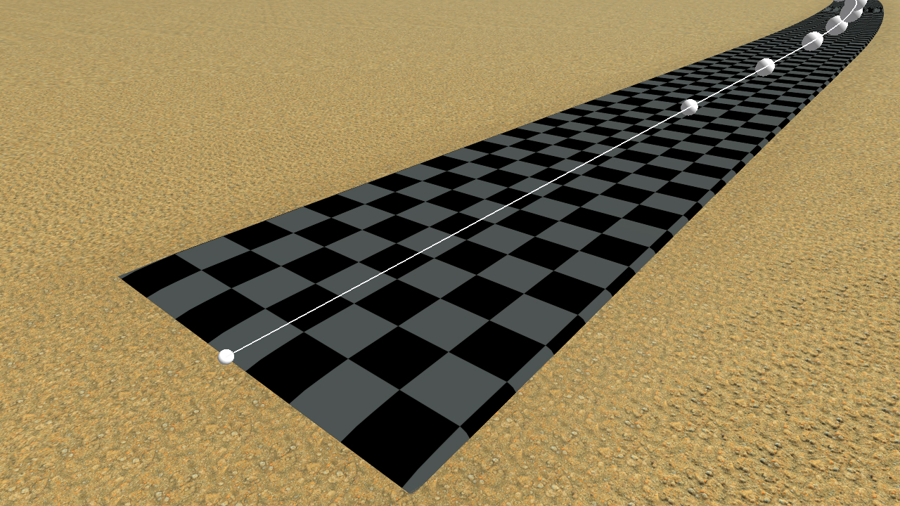
The default roadway when creating a road
The size of a single textured square is roughly 1 x 1 meter. If the network is in draft mode, then the default roadway material with the checkerboard is used, regardless of the current roadway setup.
The roadway setup
The roadway panel is raised by clicking the roadway setup button in the road commands toolbar, as shown below:
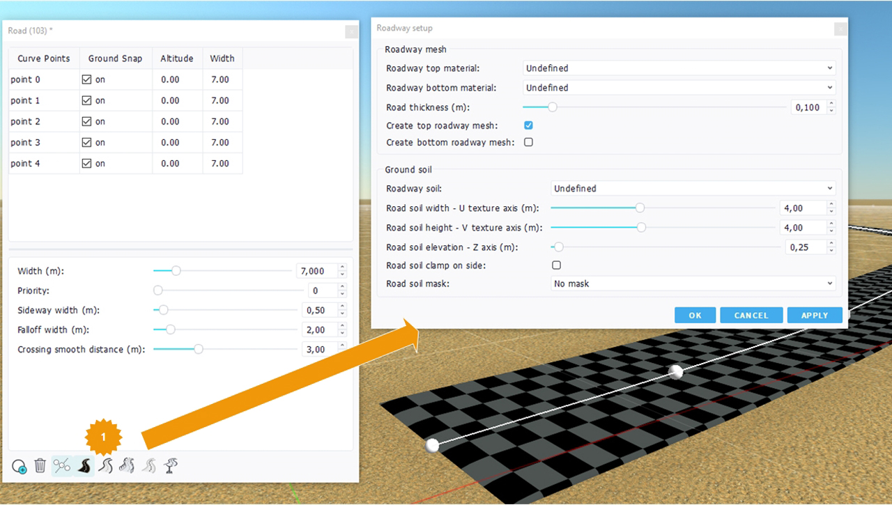
The roadway setup panel
There are two categories of items in the roadway setup panel:
- Mesh parameters: choices in mesh generation, materials, road thickness.
- Auxiliary soil parameters: choice in terms of soil to use aside the road or as a replacement for the soil mesh.
The roadway material is set for a 4 meters tiling pattern. The system adjusts road segments so that their texturing UVs can get slightly stretched to adjust on multiples of 4 meters. That way a 4 meter texture will always perfectly tile on a road.
There are two roadway materials: one for the top mesh (which is created by default) and the other one for the bottom mesh that can be created on need. The roadway bottom mesh only appears for bridges, as illustrated below:
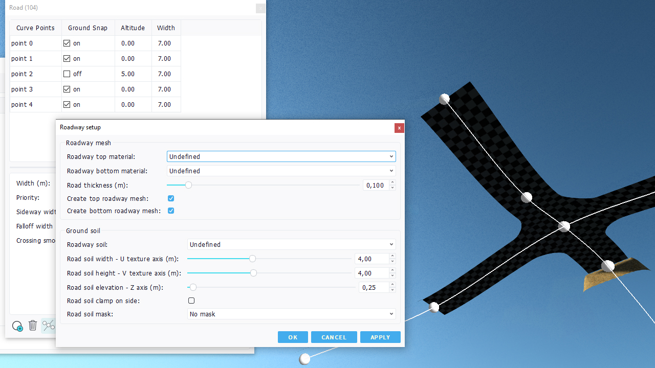
A road crossing seen from below with bottom meshes enabled for both roads
So the "Ground snap" toggle must be turned off for bottom meshes to be created.
Using ground soils
A soil can be used to replace a ground mesh. This is illustrated below. To do so, uncheck the "Create top roadway mesh" button and the soil will appear along the road path:
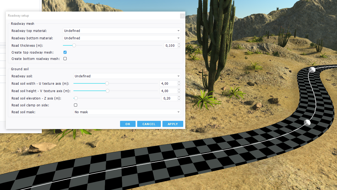
A simple road created in a desertic environment
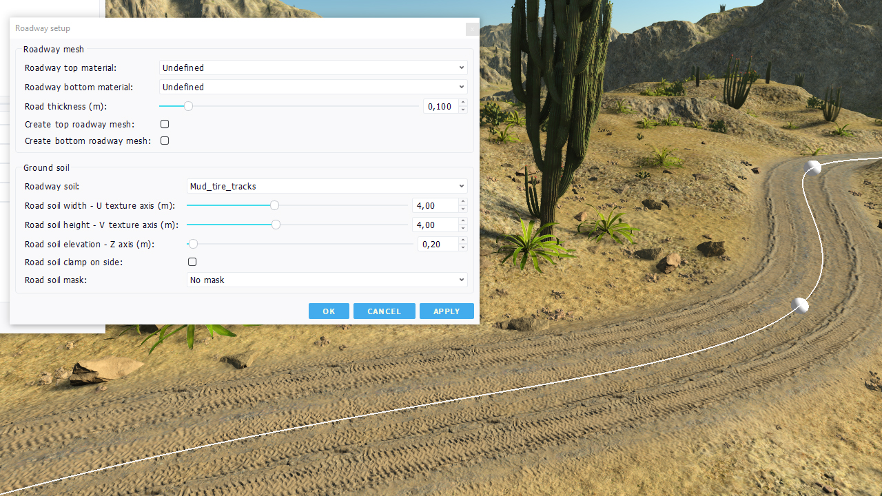
Replacing the roadway mesh with a ground soil
Some details on the road UV mapping axis system:
- The U axis of the road soil mapping is from the left side of the road to its right side.
- The V axis of the road soil mapping is along the road from its first point to its last point.
- The U origin is on the left of the road, at half width (so for a 6 meter wide road, it's 3 meters left of its curve).
- The V origin is at the first point of the road.
It may be needed to adjust the width of the road to change the left side startup point of the road.
Using a border soil
The feature described above can be used to create a variety of dirt paths, pavements (using an extra mask) or trails everywhere. It can also be used to define the border of a roadway path:
Using a border soil on a roadway (left), no border soil on the roadway, (right).
In the case of a roadway mesh being displayed, the border soils appears up to the distance specified by the "Sideway width" of the road, specified in meters:
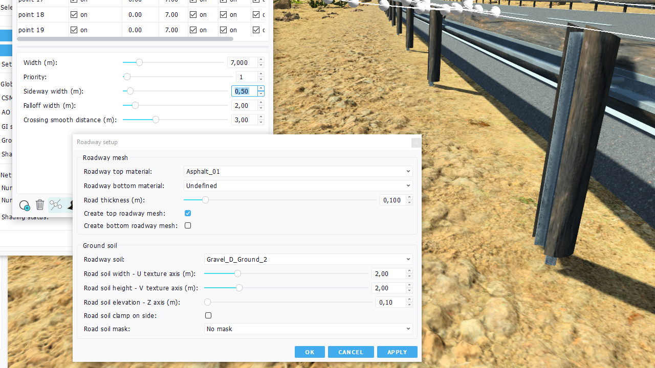
Shifting the border soil away (50 cms in that image)
So, depending on the roadway edges, sides geometries to be displayed, the "Sideway width" can be used to adjust the presence of the border soil.
 The road geometrical model The road geometrical model | Roads edges |


