

Customize classes
The class customization parameters enable you to customize how documents will be generated in your 3D scene depending on which Blueprint category they come from .
The class customization parameters are initialized by the Blueprint Stylesheets. If you change your blueprint stylsheets, all your class customization parameters will be resetted to the stylesheet's values. So make sure you setup your blueprint document in the correct order : first input data, then customization.
Project Area vs Surroundings
By default, all OSM objects are classified as "Surroundings" in NDunes. If you want, you can create a project area around your main point of interest in the map, to customize the OSM objects differently in this zone. For example, you could set higher quality assets in your project area. Or you could chose not to generate the objects at all in your project area if you choose to use exact models from a modelling software instead.
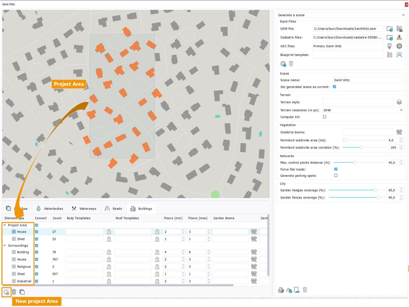
Project Area
To create a project area, clic on the "Create a project area" button. Then plot your rectangular area on your 2D map. Your OSM classes will then automatically be subdivided into two parent categories : "Project Area" (what is inside your rectangle) and "Surroundings" (what is outside).
Common parameters
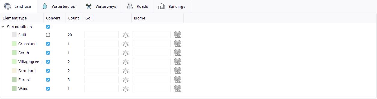
All class types ( Decal Areas, Waterbodies, Waterways, Roads, Buildings, Gardens, Geometries, Plants) share 3 common parameters :
- Element type : The different classes of objects that were detected in the input files.
- Convert : Check to convert the Blueprint objects of this class into documents during the scene generation. If unchecked, these objects will not be created, thus will not appear at all in your 3D scene.
- Count : The amount of single elements in this Blueprint class.
As a general behavior, when you can specify several documents for a single category, the documents will be assigned randomly to Blueprint objects to create variety.
Decal Area parameters
To know more about Decals in Ndunes, please refer to Decals.
Decal Area classes
The Decal Areas specific parameters are :
- Soil : One or several Soil document(s) to apply in the decal areas of this blueprint category.
- Biome : One or several Biome document(s) to apply in the decal area of this blueprint category.
- Density offset (min/max) : A density offset value, between -1.0 and 1.0, to reduce or increase the density of vegetation inside the generated Decal Area. The density offset will be applied to all plant categories (grass, bushes, rocks, trees) for this decal area. The density offset will be randomly chosen between min and max values for each decal area.
Waterbodies parameters
In the Blueprint, a waterbody is a closed water area such as a lake, and are generated as individual Waterbody documents in NDunes. To know more about Waterbodies in NDunes, please refer to Waterbodies.
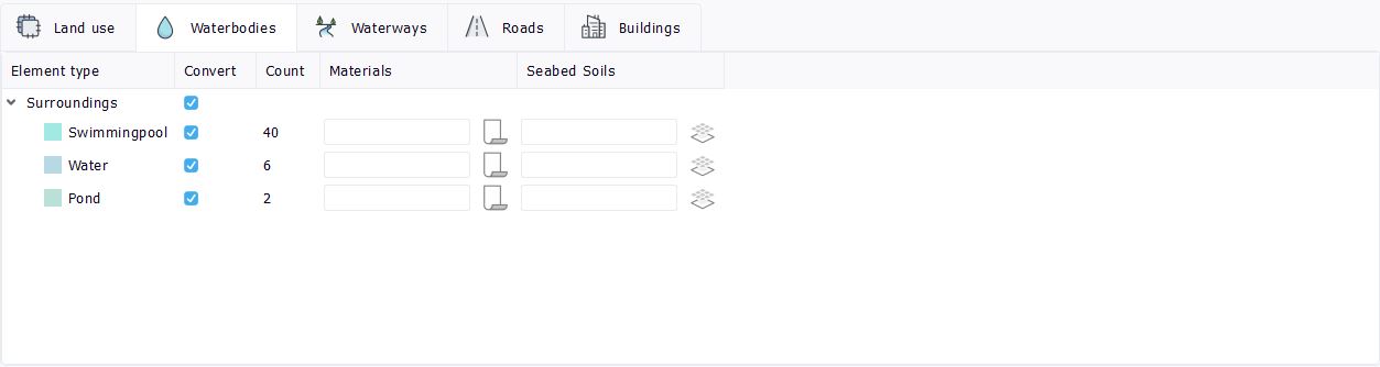
Waterbodies classes
The waterbodies specific parameters are :
- Materials : One or several Water Materials document(s) to apply in the waterbodies of this blueprint category. The material must be of type "Water" to appear in the document selector.
- Seabed Soils : One or several Soil document(s) to apply to the seabed of the waterbodies of this blueprint category.
Waterways parameters
In the Blueprint, a waterway is a linear flowing waterbody such as a river, and are generated as individual Waterbody documents in NDunes. To know more about Waterbodies in NDunes, please refer to Waterbodies.
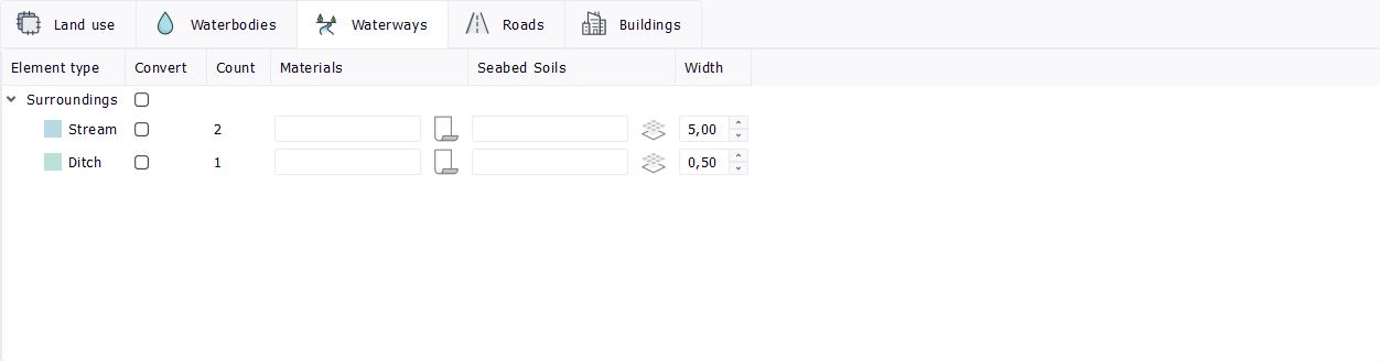
Waterways classes
The waterways specific parameters are :
- Materials : One or several Water Materials document(s) to apply in the waterways of this blueprint category. The material must be of type "Water" to appear in the document selector.
- Seabed Soils : One or several Soil document(s) to apply to the seabed of the waterways of this blueprint category.
- Width : The width, in meters, of the waterways of this blueprint category.
Roads parameters
All the blueprint roads will be generated in NDunes as individual Road documents, all belonging to a single parent City document. To know more about roads in NDunes, please refer to Roads.
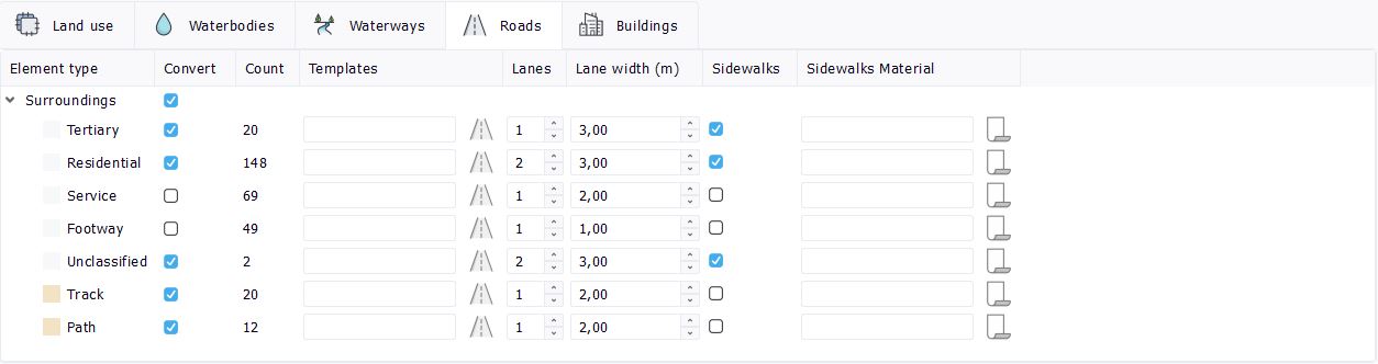
Roads classes
The roads specific parameters are :
- Soil : The selection of a soil that can be either a side soil next to the asphalt of the road, if the road has a mesh, or a soil that replaces the road, which is often used for the definition of pathes and trails.
- Width : The width of the road in meters.
Buildings parameters
All the blueprint buildings will be generated in NDunes as individual Building documents, all belonging to a single parent City document. To know more about Buildings in NDunes, please refer to Buildings.
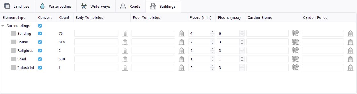
Buildings classes
Buildings have no specific parameters. These are defined by the Wizard using the city reference facades.
Gardens parameters
All the blueprint Gardens will be generated in NDunes as individual Fence documents in "closed loop" mode, all belonging to a single parent City document. To know more about Fences in NDunes, please refer to Fences.

Fences classes
The fences specific parameters are :
- Garden Biome : One or several Biome document(s) to apply as templates to the gardens of this blueprint category. If no biome is specified, the Fence will be generated with the "Has a Garden" property unchecked.
A specificity for Gardens is that shapes coming from Cadastre or BDParcellaire are automatically divided between "Garden" and "Unclassified" categories. These categories are created by NDunes, they are not part of the input 2D data. NDunes determines wether the input polygon is a real garden or not depending on several parameters such as size, number of included buildings, etc. Polygons that do not look like gardens are categorized as "Unclassified" and, by default, are not converted. Shapes coming from other sources such as CUSTOM will not undergo this classification.
Geometries parameters
All the blueprint geometries will be placed in the scene as Geomety documents instances. The Blueprint does not create new Geometry Documents, only places instances in the generated scene. To know more about Geometres in NDunes, please refer to Geometries.

Geometries classes
The geometries specific parameters are :
- Geometry : One or several Geometry document(s) to place as instances in the scene. Please note that if the Geometry document selected here is a Store documents, you won't be able to modify it once it is instanced in your 3D scene.
The geometry instances are automatically placed on the terrain but are not tangent to the terrain (no orientation).
Plants parameters
All the blueprint plants will be placed in the scene as Plant documents instances. The Blueprint does not create new Plant Documents, only places instances in the generated scene. To know more about Geometres in NDunes, please refer to Geometries.

Geometries classes
The plants specific parameters are :
- Plant : One or several Plant document(s) to place as instances in the scene. Please note that if the Plant document selected here is a Store documents, you won't be able to modify it once it is instanced in your 3D scene.
The plant instances are automatically placed on the terrain but are not tangent to the terrain (no orientation).
 Scene parameters Scene parameters | Generating the scene |
