

Creating roads
The first networking feature of NDunes is a road tool that allow you to create unconstrained road networks.
Creating a simple road
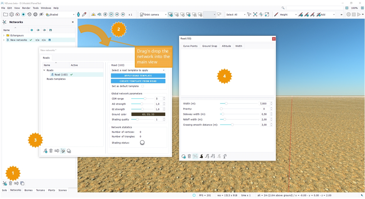
First, create a network (1), drag & drop it in the current scene (2). Then create a road (3) and double click on the road document to open it (4):
Drawing the road path
This is quite an easy job: Press the road point creation button and add a point to the road. Repeat the operation. A helpful tip is shown below that lets you quickly switch between camera manipulation and point creation:
Toggling on and off the point creation
When the point creation has been enabled for a road, the button gets checked, as illustrated below:
On the first click, a road point is created under the mouse position, at altitude zero. While the point has not been created, camera movements are disabled and clicking the left mouse button triggers the creation of the road point. Then, the road point creating button goes unchecked and camera movements are enabled again.
To create multiple points and quickly navigate / create point / navigate / ..., press 'space'. Pressing 'space' triggers the last on / off command that was activated. If the last on / off button that was pressed is the road point creation, then pressing 'space' will activate or desactivate it.
Undoing with Ctrl + Z may also be helpful to cancel unwanted point creation, when a camera movement was intended.
By default, points are created on the ground, at zero altitude, as illustrated below:
Roads auto levelling
As we have seen above, roads are created at the ground level. This means that whatever the ground level, roads points will still be on the ground. This is illustrated below where a road path has been drawn for a nearly flat ground and is updated when the ground becomes bumpy:
The ground relief is 200 m on the left and 400 m on the right. The road adapts automatically.
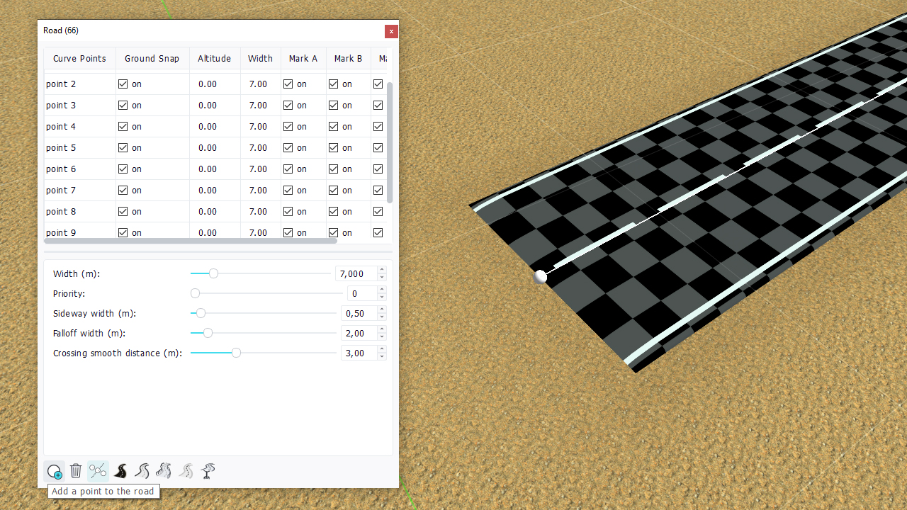
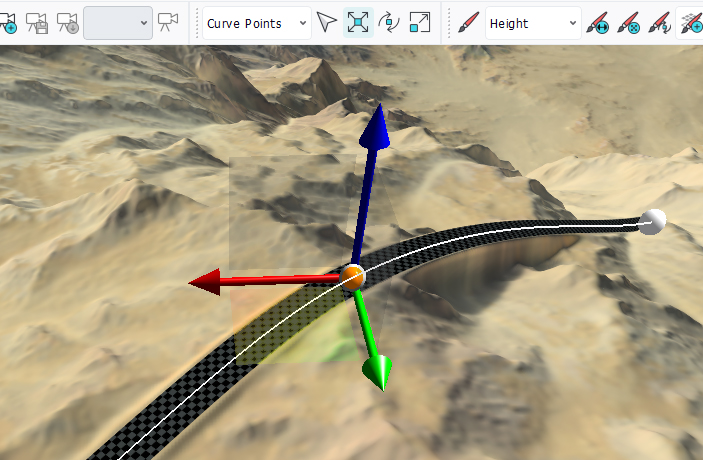
Manipulating road points
Make sure that the selection mode is set to "Curve Points" and enable a translation gizmo:
If the selection mode is "Select All", then individual curve points will not be selected. The entire curve will be selected instead.
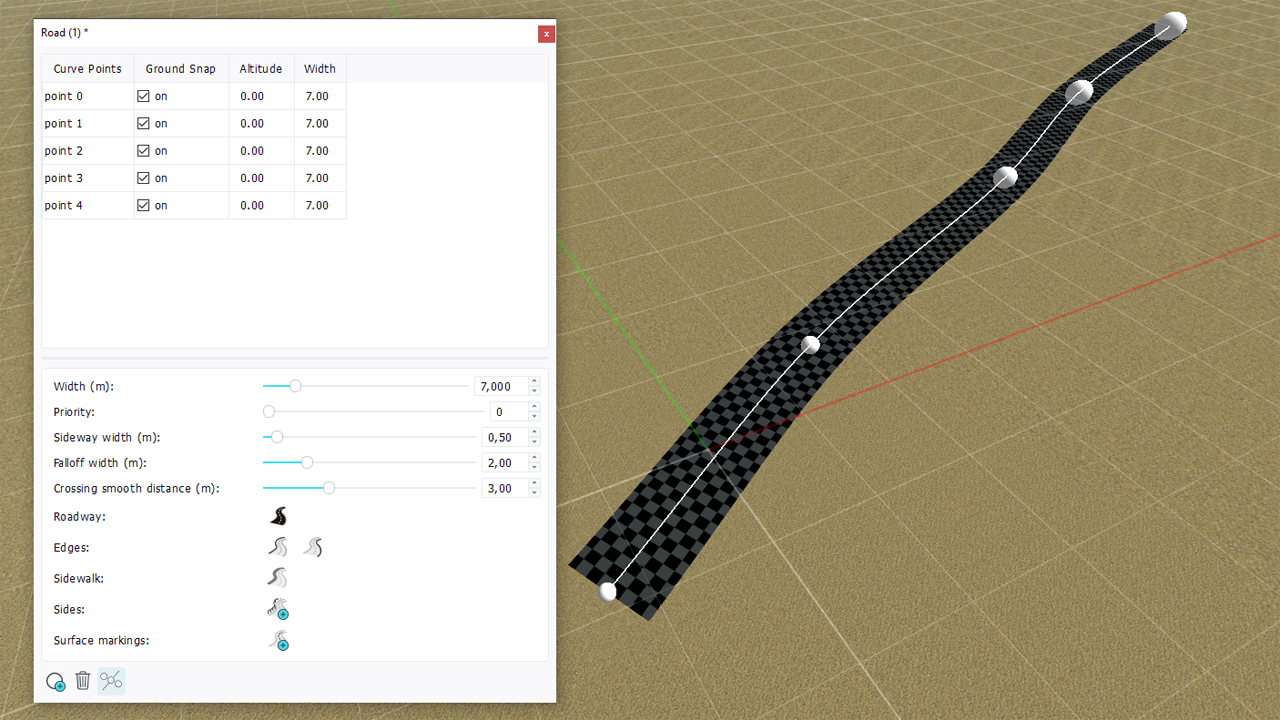
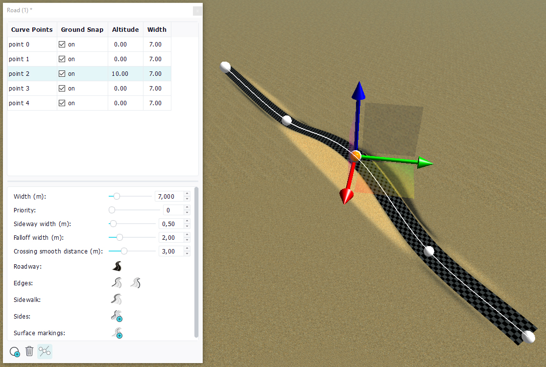
Raising or lowering road points
There are two ways to manipulate road points:
- By using the translation gizmo: points can be freely moved. On terminating the movement, the system will record the altitude of that point vs. the ground and update the road data accordingly.
- By directly entering an altitude value in the road panel parameters.
This is illustrated below:
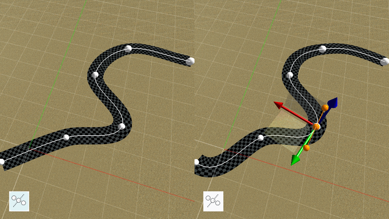
Automatic or manual control points
By default a road is created in 'automatic' mode. This means that the road is automatically defined using the road points that define it. The connectivity between the road points is automatically generated by the system. By unchecking the 'toggle automatic / manual control points button', the road can be defined manually and all road segments tangencies can be manually adjusted. This is shown below:
 Networks Networks | Crossing roads |
