

Adding masks
A common channel added to soils is a mask. It is used to identify a region in the soil. A mask is added in the "Masks" tab of the soil, as any other channel in the soil. Below an example of a mask that identify steep slopes in our "New soil" we started creating before:
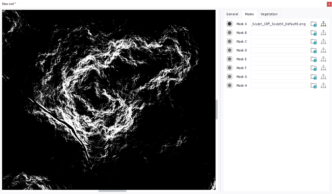
Masks can be either supplied or generated by modifying a base image using the Graph editor. A terrain can have up to 8 different masks. These masks images are found back in the terrain editor and can be dragged then to restrict the display area of a secondary soil:

We see that the "a" icon of the mask subbox has a valid contents. Note that the actual contents of a soil in a terrain appears only if that soil has been loaded in memory. This requires that the soil has been opened or that the terrain has been set as the current terrain in the main view.
 First level soil vs. secondary soils First level soil vs. secondary soils | Defining vegetation densities |
