

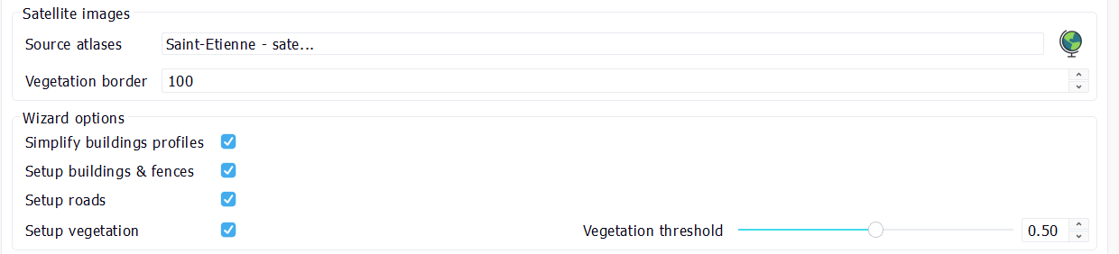
 Wizard
The city has a wizard button (first icon in the main toolbar in the city view, see City interface). The wizard uses satellite imagery enclosed in Atlases to guess and enhance some geometrical properties of elements in a city. It can perform the following tasks:
- Simplify buildings profiles (remove some redundancies for instance, turn the building curve so that the first wall is close to a road),
- Guess the height of buildings, apply facades to them, setup fences, pickup roofs facades that match satellite imagery the best,
- Setup roads with facades,
- Calculate a vegetation layer that matches the satellite imagery.
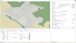
The city wizard require satellite imagery to be given to it as data source input:
Note:
Please make sure that you have the necessary license rights to use satellite imagery during the city wizard process:
- NDunes will read supplied images (through atlases) and perform pixel image analysis on them.
- NDunes will not copy or reuse any part of the source satellite imagery.
- NDunes can't be made liable of IP violation for user images provided to it and used during calculation processes.
There are two kinds of satellite imagery that can be provided to the city wizard:
- Aerial photographies: are top level atlases generated from satellite imagery. These must have been filled with the proper sun directions in order for the image analysis to be performed. This is done at the atlas level, when setting up the image prior to any wizard calculation.
- Height images: These images are height numerical models. They contain elevation informations on buildings and vegetation. Nothing else. These are generally extracted from countries LIDAR scans and are used by the wizard to define buildings height in a more accurate way than what can be done with aerial photographies.
The vegetation multiplier option is used to increase or to decrease the amount of vegetation calculated by the wizard. The vegetation is calculated from a city part up to the specified "border" away from it. The city parts involved in the calculations can optionnally contain roads and / or fences.
A practical city wizard example
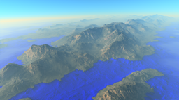
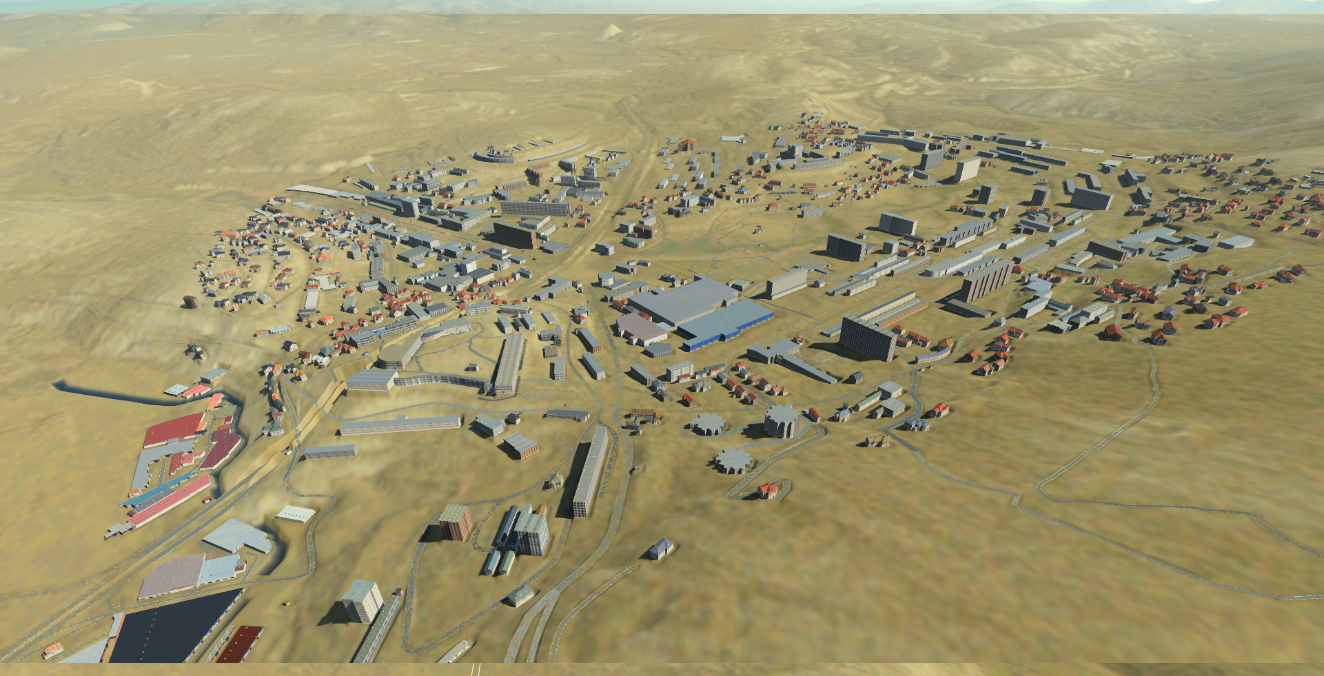
We start from a blueprint with an open street map file that provides us buildings and roads present in that part of the city - in the south of France - we're going to generate. In the blueprint configuration, we have setup an external city filled with facades already. It's called "City draft template" on the NDunes store. Here's the raw scene generated from the blueprint:
The landscape has been generated using NDunes store atlases at 5 meters resolution. So we have a pretty accurate landscape definition in that scene.
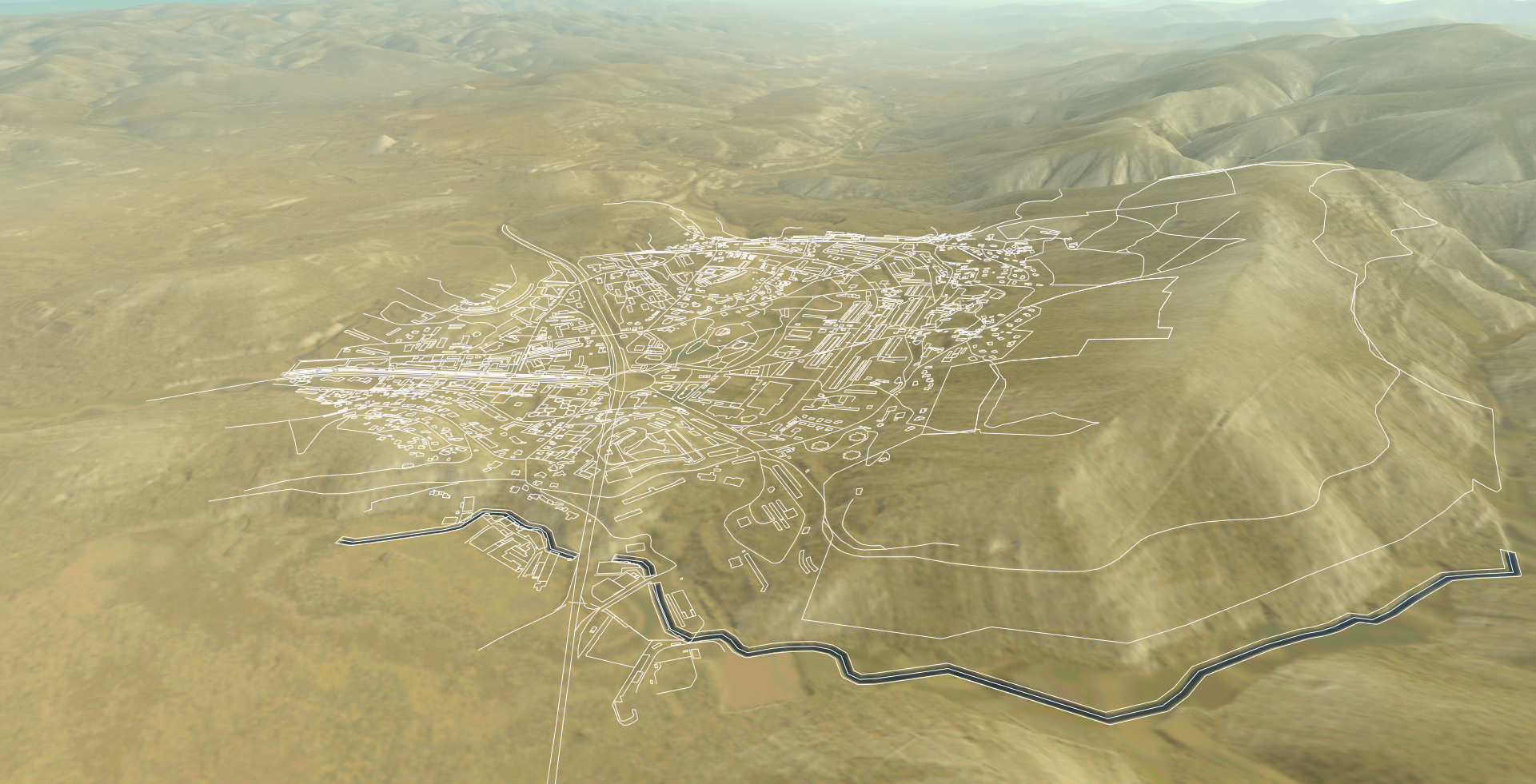
We then simply launch the city wizard. That step does not produce anything visible. Then, we refresh the city and get the following scene:
If we add a biome to it, we can also see how the vegetation layer has been calculated by the wizard:
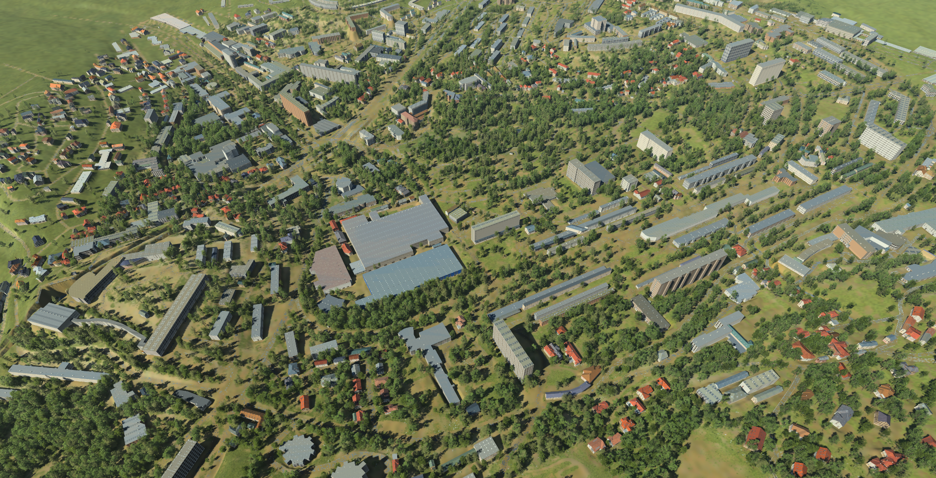
We can see that every building has been mapped with facades supplied by the external city with facades. We also see that heights have been setup for each building, including roof slopes, based on the kind of building we have (this is sourced from the blueprint).
All results provided by the wizard are approximative, and are intended on providing a base setup of an entire city in a few clicks, thus saving a lot of time for far away views that require no closeup high quality setup.
Among these, heights generated may be inacurrate. They can be wrong depending on what we can see from the satellite imagery supplied. For instance, the wizard will not be able to guess the height of a garden shed hidden by the canopy of trees. Similarly, because the wizard uses sun shadow projections to guess elevation of buildings, some shadows that aren't accessible (due to connected buildings for instance) may prevent the wizard to generate accurate results.
 | Facades |
