


 Preparing an atlas for the city wizard
Atlases that contain satellite imagery can be used by Cities for the calculation of city parameters, such as buildings heights, roof texture coloring or for the definition of vegetation layers.
Note:
Please make sure that you have the necessary license rights to use satellite imagery during the city wizard process:
- NDunes will read supplied images (through atlases) and perform pixel image analysis on them.
- NDunes will not copy or reuse any part of the source satellite imagery.
- NDunes can't be made liable of IP violation for user images provided to it and used during calculation processes.
In order to be able to proceed with city Wizard calculations, we need two critical informations:
- The sun direction,
- The off-nadir angle used by the satellite to take the shot.
Once these informations are setup as detailed below, the atlas can be used by the city wizard.
The sun direction
The sun direction is recorded by adding a marker to the scene from the atlas. It's dropped from the atlas cartography tab, its size is set and we compare some known height with the shadow being cast. Here's an example below...
We start from the satellite imagery imported into an atlas:
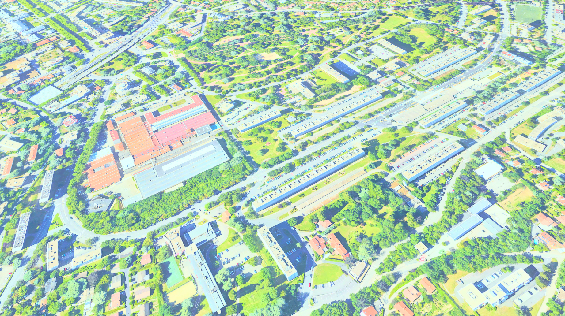
As we can see, the image is overbright. This is a normal effect, since the satellite photo shot was taken during daylight and this picture is seen flat in NDunes which also has a sun & sky lighting. So we have a double lighting contribution in the image. This don't matter for the sun direction definition. Next, we drop a sun marker - see the icon in the toolbar, drag it into the scene - onto the image at a position where we can see the shadow cast by some element:
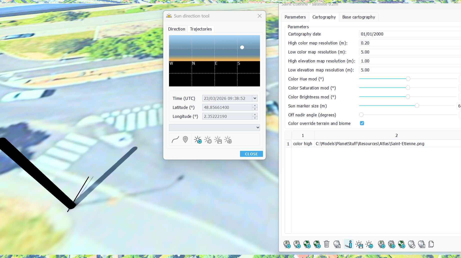
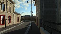
We need an element with visible shadows and a known size - thank you streetview - to be able to set the proper marker size. We use the sun panel tool then to adjust the sun position:
Then we need to save the setup sun direction - in the toolbar icon aside the marker drop - and the atlas can be used by the city wizard.
The off nadir angle
The other parameter that needs to be recorded is the drifting direction of the satellite compared to the vertical. This is mostly visible on high buildings, as shown below:

The building edge is drifting upward in the image. If the satellite shot had been taken with the satellite right above the building, we wouldn't see such a drifting of the vertical edge of the buildings. This is the information we need to record:

By changing the off nadir angle, you need to align the small bar of the marker with the vertical edge of a building. Once done, save the atlas.
 Using QGIS to prepare NDunes cartography Using QGIS to prepare NDunes cartography |
