

The atlas layer
The atlas layer is the first level of a terrain construction. It acts as a kind of basement and it's always available, even for an empty terrain:

From left to right we find:
- The temperature and rainfall that'll be used for the terrain design.
- The color of the atlas soil.
- The height of the atlas soil.
- The ambient occlusion influence of the atlas.
- The reflectance of the atlas soil.
- The density values for each category of plants that can be spread by Biomes.
The atlas does not produce any visible effect until a first level soil gets added to it. It's kind of invisible and only works by influencing other terrain soils.
Influencing soils
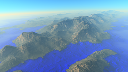
Let's start with a simple terrain made with a first level soil:
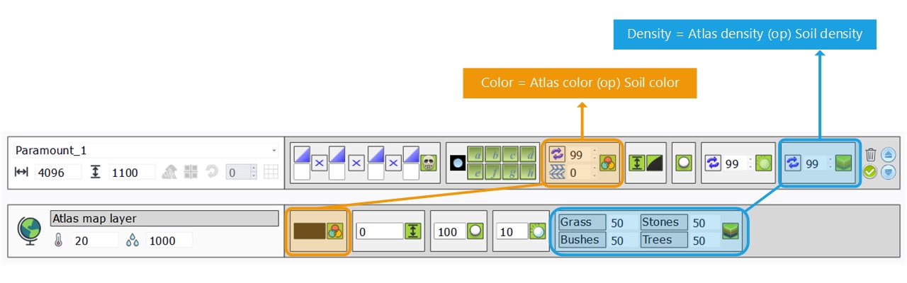
Every landscape definition parameter will result of a combination of the atlas layer with the first soil layer. In the picture above we show the combinations for the color (highlighted in orange) and the combination for the densities (highlighted in blue). Combinations occur also for the terrain elevation (height), ambient occlusion and reflectance. The combination is always like CURRENT_VALUE (OPERATOR) TOP_SOIL_VALUE. The CURRENT_VALUE results of the atlas and all soils combined up to now and the TOP_SOIL_VALUE is the set of values of the last dropped soil (so the soil on top of the stack). These two values are mixed using OPERATOR (for instance multiply, add, subtract,...)
There are default combinations that take place:
- The color, reflectance and densities combinations are controllable: the OPERATOR can be selected from the dropdown in the each corresponding box (left click to see the list). The default operator when a soil is dropped is REPLACE, meaning that the CURRENT_VALUE will be ignored and only the TOP_SOIL_VALUE will be used. This means that we don't care of the value before it: we replace it by our own value.
- The height and ambient occlusion combinations are fixed to the OVERLAY operator and can't be changed. The overlay operator mixes the TOP_SOIL_VALUE with the CURRENT_VALUE using the difference to the mean of the CURRENT_VALUE. Practically, the bright part of the dropped soil will brighten the CURRENT_VALUE while its dark parts will darken it.
All operators and their effects are detailed here: Soil blending operators.
Let's see some practical samples on a simple terrain:
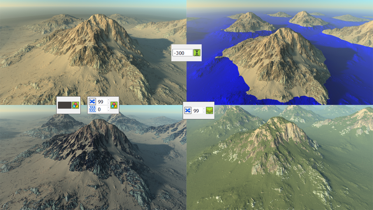
From the top left reference image:
- To get to the bottom left corner, we change the color blending operator of the first soil to OVERLAY and we also set a quite dark atlas color.
- To get to the top right corner, we change the height of the atlas, thus sinking the terrain by 300 meters.
- To get to the bottom right corner, we change the density blending mode of the terrain to OVERLAY so that it inherits from the atlas value (50% by default). To get this image, we also have added a biome (see Biomes) to the scene.
 Refining a terrain Refining a terrain | The first level soil |
