

Customizing the seabed and the shoreline
Specifying the seabed
In the next tab of the waterbody document view, you will be able to define the specifications of the seabed. The seabed is the area that is under the water surface. This part is very close to the decal area specifications, so please refer to the Decals for precise documentation.
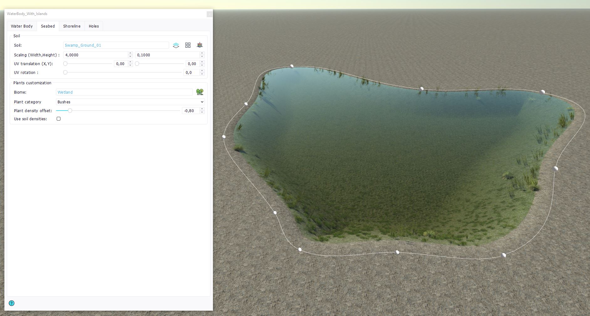
You can add a specific soil to your seabed, by selecting a soil document in the "Soil" selector. You can also drag & drop a soil document inside the waterbody in the viewport. As in Decals, you can specify the scaling and UV mapping of the soil, as well as wang tiling and triplanar mapping.
For the plants customization of the seabed, you can add a specific biome to your seabed, by selection one in the "Biome" selector or directly drag & dropping a biome document inside the waterbody. You can add density offsets for each plant category to adjust the quantity of the plants spawning under water, or use the soil densities that were defined in the seabed soil.
Specifying the shoreline
In the next tab of the waterbody document view, you will be able to define the specifications of the shoreline. The shoreline is an optional outside area bordering the waterbody contours.
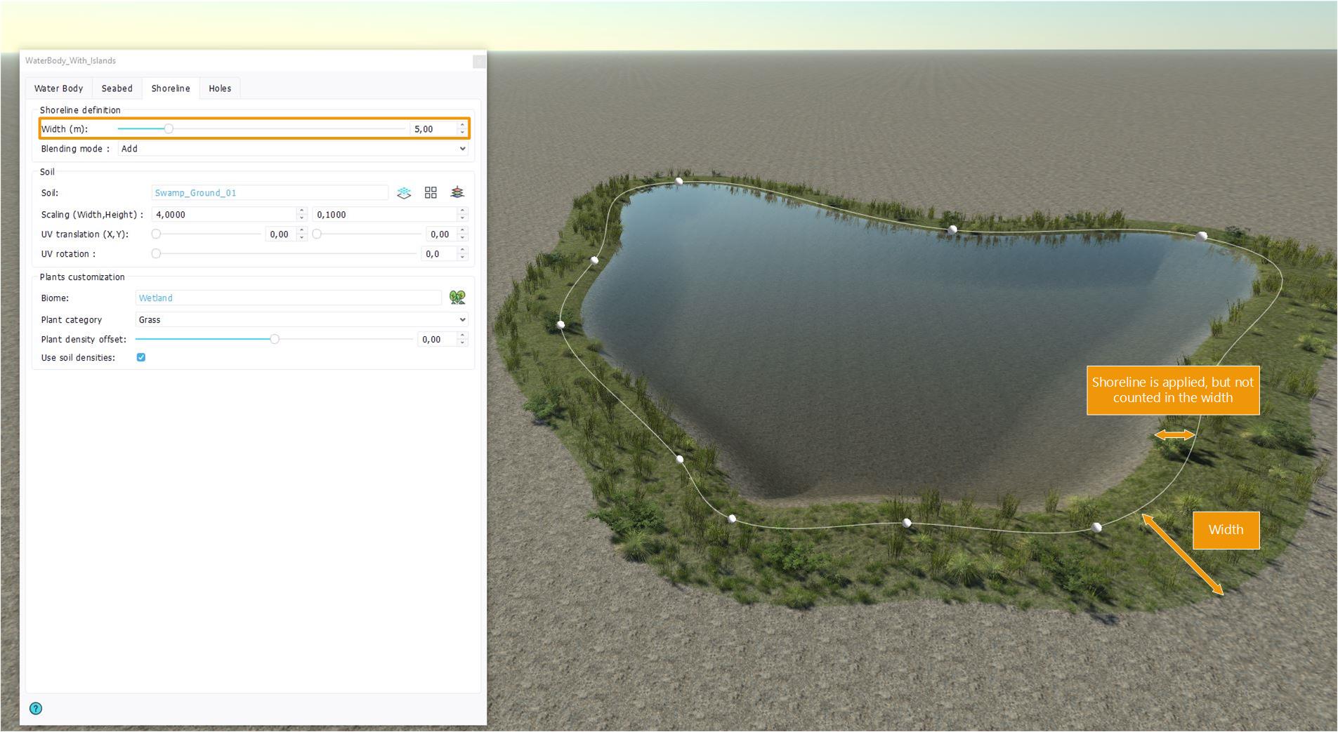
First, to create a shoreline area, go to the "Shoreline definition" section and set the width value of the shoreline. The width is in meters and starts from the waterbody curve, even though the shoreline specifications are also applied inside the curve and until the water surface.
You can then setup your shoreline just as you did your seabed : by adding a soil and / or a biome.
 Setting up the water rendering Setting up the water rendering | Creating islands |
